
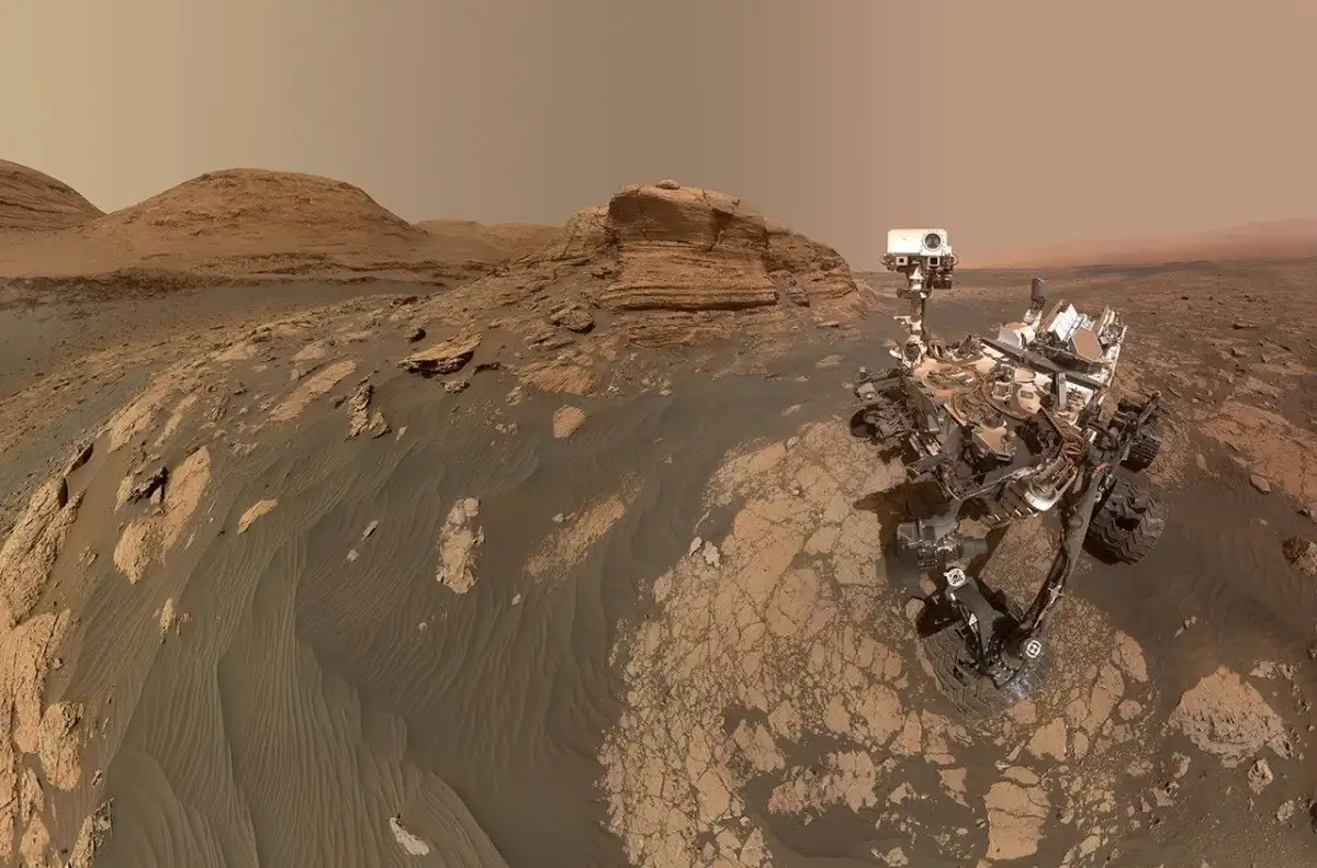
On April 5, 2026—the 1,882nd Martian sol of its mission—NASA’s Perseverance rover utilized its Mastcam-Z imaging system to document a landscape now labeled as 'Arbot'. The resulting mosaic, composed of 46 individual frames, captures a geologically diverse environment characterized by varied rock textures shaped by long-term aeolian (wind-driven) processes.
The data, representing the rover’s current westernmost excursion beyond the Jezero Crater, provides high-resolution evidence of Martian surface morphology, with versions processed for both natural visual representation and enhanced contrast to distinguish subtle mineralogical variations.
Technical Composition
The imagery produced is part of an ongoing collection of panoramic views that have been standard for the mission since its inception.
| Feature | Details |
|---|---|
| Location | 'Arbot', west of Jezero Crater |
| Date of Capture | Sol 1,882 (April 5, 2026) |
| Instrument | Mastcam-Z camera system |
| Mosaic Size | 46 individual images |
Context and Utility
The mission's continued movement toward the west serves to push the boundaries of current site exploration. While the visual output provides immediate aesthetic and topographical utility for planetary scientists, it remains a fragmented perspective—a sliver of the planet's vast, uninhabited crust.
Read More: US Space Force Victus Haze Mission Successfully Tests Orbital Intercepts
Geological Framing: The mission team classifies this as one of the "richest geological vistas" observed thus far, primarily due to the complex textural stratification visible in the rock formations.
Methodology: The distinction between the "natural" and "enhanced" versions reflects a standard cartographic practice where color bands are mathematically stretched to expose features that the human eye might otherwise miss.
Reflective Note
As of today, May 18, 2026, the mission enters a phase of deepening geographic inquiry. The focus remains on terrain traversal, where each captured pixel contributes to a massive, iterative database of the Martian interior. The act of imaging these remote locations serves as a persistent anchor for human observation, regardless of the objective difficulty of accessing these regions in physical form.


