
The World Meteorological Organization (WMO) has issued a significant alert regarding the escalating risk of extreme heat and weather events globally, directly linked to the anticipated continuation of the El Niño phenomenon. Current projections indicate El Niño conditions are likely to persist until at least November, with above-average global temperatures expected between June and August. This development follows a notable shift in the equatorial Pacific, where sea surface temperatures have seen a rapid ascent from late April to mid-May.
Intensity and Uncertainty Cloud El Niño's Trajectory
While the WMO's statements point towards a developing El Niño, a degree of uncertainty surrounds its precise strength. Some climate models are not predicting a particularly robust event, leaving a range of possibilities from a moderate to a potentially strong El Niño. The underlying driver for El Niño's emergence has been identified as warm ocean waters.
Read More: Paris Weather Changes: Rain and Wind Expected Tonight
"El Nino conditions will pour fuel on the fire of a warming world." - U.N. Secretary-General António Guterres
This impending natural climate cycle, characterized by a periodic warming of sea surface temperatures in the central and eastern Pacific Ocean, is expected to compound existing global warming trends. The U.N. Secretary-General, António Guterres, has voiced concerns, drawing a parallel between El Niño and a catalyst for an already warming planet, and has reiterated calls for a transition away from fossil fuels toward renewable energy sources.

Global Ocean Heat Reaches New Highs
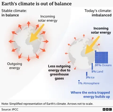
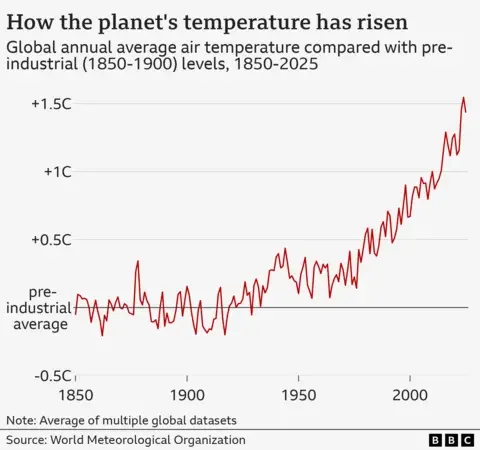
The escalating temperatures are not solely attributed to the El Niño forecast. The WMO has reported that the heat stored in the upper two kilometers of the global ocean reached a new peak last year. This persistent warming trend has led scientists to observe that the Earth's climate is increasingly out of equilibrium compared to any point in recorded history, though temperatures broadly remain within the range of long-term predictions, with last year still ranking among the three warmest on record.
Read More: El Niño Amplification May Cause More Weather Problems
Broader Impacts and Scientific Observations
Scientists are closely monitoring the situation, with some forecasting the potential for the strongest El Niño on record. Such an event could significantly redistribute heat across the planet, amplifying the impacts of human-caused climate change. The phenomenon, a natural climate pattern, involves warmer-than-average sea surface temperatures in the equatorial Pacific. Its typical duration spans nine to 12 months.
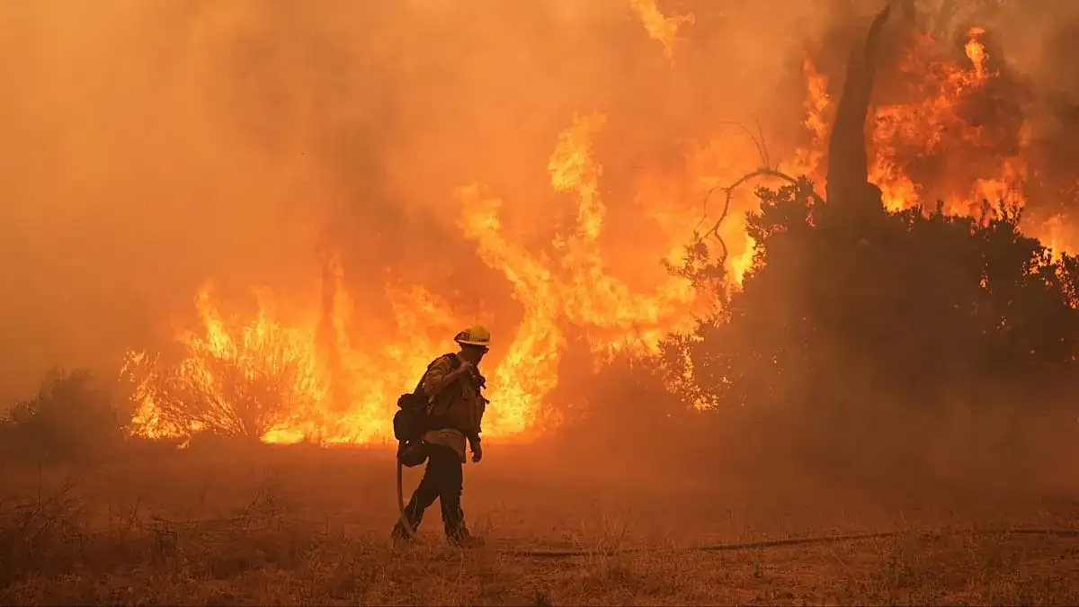
Reports suggest that "super El Niños," which are more rare occurrences, could emerge this year, potentially leading to record-breaking heat and a surge in extreme weather events worldwide. Scientists categorize El Niño alongside La Niña (when sea surface temperatures are below average) and neutral conditions. The observed warming trend in the Pacific suggests El Niño conditions are solidifying. The potential for a strong El Niño, forecast to commence this fall, has raised concerns about additional global heat records and increased risks of droughts, wildfires, and other extreme weather phenomena, particularly in regions like the western United States, which has already experienced unseasonably warm conditions.
Read More: Calgary Rain Causes River Levels to Rise Across Alberta


