
A Shift in Weather Brings Winter Hazards
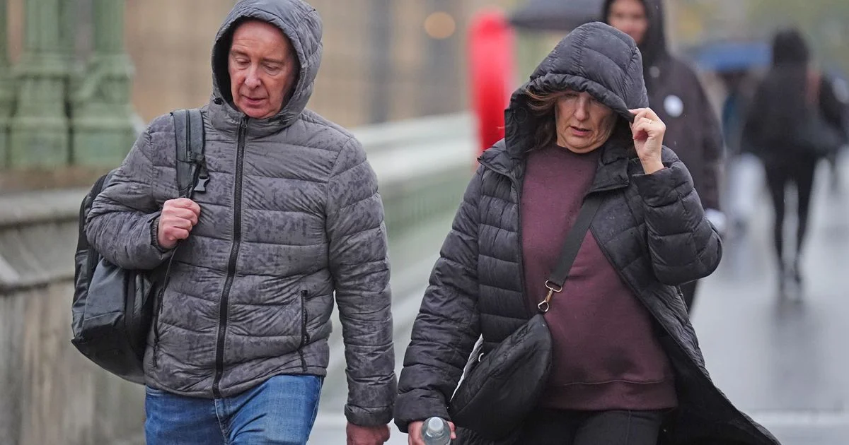
The United Kingdom is experiencing a notable change in weather patterns. Following an extended period of heavy and persistent rain, the nation is now bracing for snow and ice. This shift introduces new risks, including travel disruption and potential hazards from slippery conditions. Authorities have issued weather warnings across various regions, highlighting the seriousness of the impending winter conditions.

Extended Period of Unusually Wet Weather
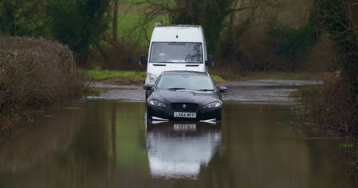
For 42 consecutive days, parts of the UK have endured continuous rainfall, setting a new record. This relentless wet spell has been attributed to low-pressure systems that have stalled over the country. These systems have been unable to move eastward due to a block of cold air over Scandinavia. The sustained low-pressure and subsequent rainfall have led to widespread flooding and saturated ground conditions across many areas.
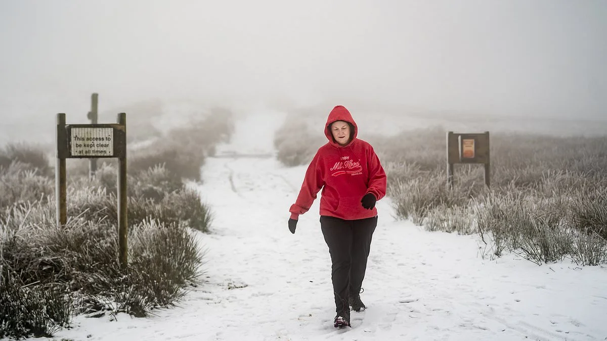
Snow and Ice Warnings Issued
The Met Office has put in place yellow weather warnings for snow and ice, affecting several parts of the UK.
Read More: BT Adds £13.09 Charge to Landline Bills for UK Customers Starting Next Month
Timing: These warnings are active from Thursday evening through to midday on Friday. Specific times include Thursday, February 12, from 7pm until midnight on Friday, February 13.
Affected Areas: Warnings are in place for:
Much of Scotland.
Northern England, including North East England (Newcastle upon Tyne, Redcar and Cleveland, Stockton-on-Tees), North West England (Greater Manchester), and Yorkshire & Humber (East Riding of Yorkshire, North Yorkshire, South Yorkshire).
Forecasted Conditions: Snow showers and freezing temperatures are expected. There is a possibility of icy patches on untreated roads, pavements, and cycle paths. Some areas could see up to 10cm of snow, particularly on higher ground.
Potential Impacts: These conditions carry a medium likelihood of low impact, but could lead to some travel disruption. Injuries from slips and falls on icy surfaces are also probable.
Health Alerts Issued
In addition to weather warnings, a cold weather health alert has been issued by the UK Health Security Agency (UKHSA). This alert spans from Friday morning to Monday morning. While the UKHSA typically issues warnings for England, separate snow and ice alerts are also active for northern England and most of Scotland.
Contributing Factors to Persistent Wet Weather
Forecasters suggest that the persistent wet weather has been caused by the displacement of the jet stream. This has allowed Atlantic low-pressure systems to be steered towards the UK. A concurrent cold air mass over Scandinavia has prevented these weather systems from moving east, leading them to stall over the UK, particularly in the south and southwest. The unusual warmth in northern Canada and Greenland, coupled with cold conditions in parts of the USA and Europe, has also influenced the jet stream, making it more powerful and potentially contributing to the stalling of weather patterns.
Read More: Hawaii Flooding Displaces Thousands Including Jason Momoa After 20-Year Rain Event
Expert Analysis on Jet Stream Influence
"Unusually warm weather across northern Canada and Greenland, combined with abnormally cold conditions across parts of the USA, Scandinavia and northeast Europe, has strengthened the jet stream, producing a more powerful flow than normal. That has meant they have stalled over the UK - particularly the south, southwest, Northern Ireland and eastern Scotland."
This observation highlights how global weather phenomena can have a localized, prolonged impact on regional weather systems. The dynamics of the jet stream appear to be a key factor in the UK’s recent prolonged wet spell.
Outlook and Next Steps
The immediate concern is the transition from heavy rain to snow and ice. While the rain is expected to continue for several more days, colder air is moving in, bringing with it the risk of winter hazards. Residents in affected areas are advised to stay informed about weather forecasts and take necessary precautions to avoid travel disruption and potential injuries. The UKHSA alert also underscores the need for vulnerable individuals to take extra care in the colder temperatures.
Sources:
Met Office Official Warnings: https://weather.metoffice.gov.uk/warnings-and-advice/uk-warnings
Context: This is the official source for weather warnings and advice issued by the UK's national meteorological service.
Liverpool Echo - Met Office Issues Yellow Weather Warnings: https://www.liverpoolecho.co.uk/news/uk-world-news/met-office-issues-yellow-weather-33408495
Context: Local news outlet reporting on the Met Office's weather warnings.
Liverpool Echo - Full List of Areas Under Warnings: https://www.liverpoolecho.co.uk/news/uk-world-news/full-list-areas-under-met-33402808
Context: Local news outlet providing a comprehensive list of areas affected by weather warnings.
Sky News - Cold Weather Health Alert Issued: https://news.sky.com/story/cold-weather-health-alert-issued-as-met-office-warns-of-incoming-snow-and-ice-13506099
Context: National news outlet reporting on both weather warnings and health alerts.
The Mirror - When Will Rain End: https://www.mirror.co.uk/news/uk-news/uk-weather-rain-end-after-36704343
Context: National news outlet investigating the causes and duration of the recent heavy rainfall.
Birmingham Mail - Met Office Speaks Out After 42 Days of Rain: https://www.birminghammail.co.uk/news/midlands-news/met-office-speaks-out-after-33407842
Context: Local news outlet featuring commentary from the Met Office regarding the prolonged rainfall.
Daily Mail - UK Braces for Heavy Snow: https://www.dailymail.co.uk/news/article-15549151/UK-snow-Met-Office-yellow-weather-warning.html
Context: National newspaper reporting on the snow warnings and potential snowfall amounts.
Evening Standard - Snow and Ice Alert as Winter Weather 'Stuck on Repeat': https://www.standard.co.uk/news/uk/snow-and-ice-warning-met-office-winter-weather-b1270557.html
Context: London-based newspaper covering the latest weather warnings and the persistent nature of winter weather.
Evening Standard - Snow and Ice Warnings Issued as Arctic Air Blows In: https://www.standard.co.uk/news/environment/scotland-aberdeenshire-met-office-snow-north-west-b1270551.html
Context: London-based newspaper reporting on the arrival of Arctic air and its associated snow and ice warnings.
Evening Standard - Why UK's Weather Has Been Relentlessly Wet: https://www.standard.co.uk/news/uk/why-the-uk-weather-wet-2026-weather-b1270573.html
Context: London-based newspaper examining the meteorological reasons behind the extended period of rain.
Liverpool Echo - All to Know as Snow and Ice Warnings Issued: https://www.liverpoolecho.co.uk/news/uk-world-news/know-snow-ice-warnings-issued-33404968
Context: Local news outlet providing comprehensive information on the new snow and ice warnings.


