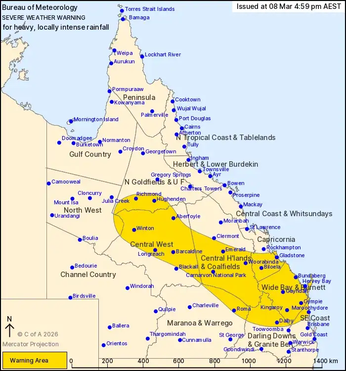
A significant weather system is triggering a state-wide Flood Watch across much of Queensland, accompanied by numerous Severe Weather Warnings for heavy rainfall, and a Marine Wind Warning Summary is also in effect. Multiple river systems are under various flood warnings, ranging from minor to major, indicating a broad and pervasive threat across the state. This comes as a tropical low east of Cairns is expected to bring severe weather to the north.
WARNINGS SPANNING THE STATE
The Bureau of Meteorology has issued a broad 'Flood Watch for most of Queensland', signalling the potential for widespread flooding across numerous catchments. This overarching alert is complemented by a suite of specific flood warnings for individual river systems:
Major Flood Warnings: Issued for the Burnett River, the Thomson and Barcoo Rivers and Cooper Creek, and the Flinders River, as well as the Georgina River and Eyre Creek.
Moderate Flood Warnings: In place for the Don River, Connors and Isaac Rivers, Baffle Creek, Upper Brisbane River, Charleys Creek, and the Mary River.
Minor Flood Warnings: Active for the Tully River (final warning), Herbert River, Haughton River, Burdekin River, Pioneer River, Dawson River, Bungil Creek, Warrego River (QLD), Paroo River (QLD), Diamantina River, Burrum and Cherwell Rivers, and the Maroochy and Noosa Rivers. Also a minor warning for Myall Creek and the Lower Condamine River.
Flood Warnings: Issued for the Proserpine River catchment, Nicholson and Albert Rivers, and the Gilbert River.
Simultaneously, a Severe Weather Warning has been issued for the Capricornia, Wide Bay and Burnett, and parts of the Central Highlands and Coalfields, Central West, Darling Downs and Granite Belt, and Southeast Coast forecast districts. This indicates a threat of heavy rainfall, which is a common precursor to the flood events being warned about. A Marine Wind Warning Summary for Queensland further underscores the expansive nature of the current weather activity.
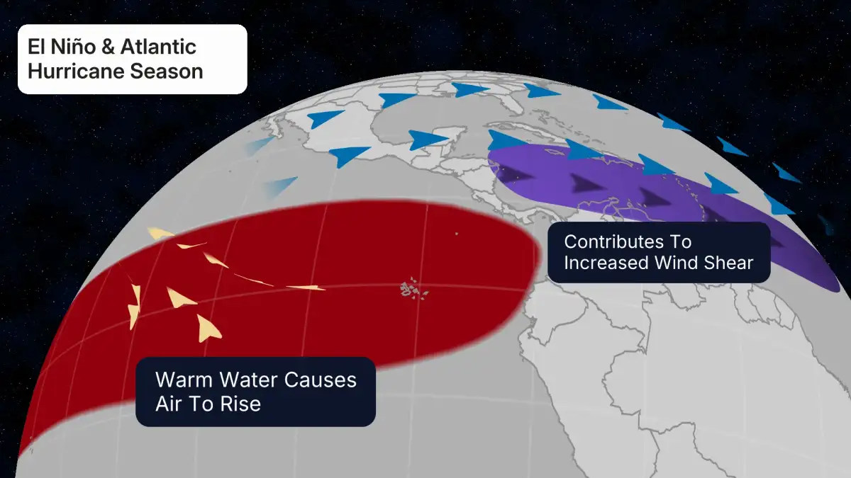
Read More: El Niño May Come to Australia, Weather May Change
North Queensland Focus
Separately, a tropical low situated in the Coral Sea, approximately 360 kilometres east-north-east of Cairns, is projected to bring severe weather to the far north Queensland mainland. A severe weather warning has been issued for the Far North Queensland Peninsula, North Tropical Coast and Tablelands, with heavy rain anticipated. The system is expected to make landfall on Queensland's North Tropical Coast, likely south of Ingham, on Friday afternoon. The heaviest rain, however, is forecast to remain north of the system's core.
BACKGROUND AND CONTEXT
The issuance of these extensive warnings highlights Queensland's ongoing vulnerability to extreme weather events. Authorities are reiterating the importance of staying informed through trusted sources. Resources are available from 'Get Ready Queensland' and official meteorological services to help residents understand and prepare for these conditions. The situation is dynamic, with updates disseminated through official channels like the Queensland Government's disaster management portal and the Bureau of Meteorology.
Read More: Why Paul Keating called Australia a banana republic in May 1986