Torrential rain has saturated Far North Queensland, with a tropical low making landfall near Innisfail on Friday. Residents were advised to prepare for potential flash flooding and to seek higher ground, as authorities deployed emergency services to the region.
The deluge, described as hammering the region, brought significant rainfall across parts of Far North Queensland. Some areas recorded up to 400mm of rain as a tropical low crossed the coastline. The weather system, initially a cyclone watch that was later cancelled, has brought wild weather with more downpours predicted. The 'Bureau of Meteorology' (BOM) indicated the system's effects could extend to coastal communities further south, through to Central Queensland, within the next 48 hours.

Authorities issued warnings for residents to remain vigilant and observe flood emergency advisories. Sandbag stations were reportedly in place. The impacts on local infrastructure were evident, with the Daintree Ferry being torn from its moorings due to severe flooding. Additionally, the Bruce Highway south of Cairns was shut down as floodwaters rose.
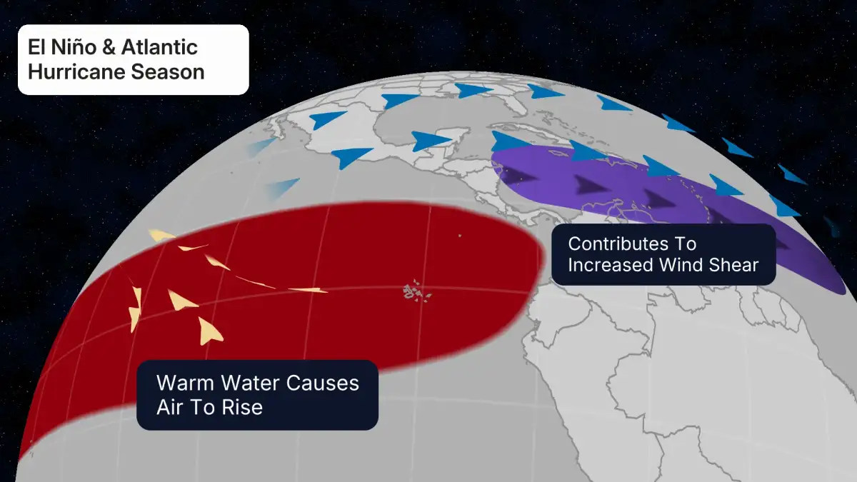
Read More: El Niño May Come to Australia, Weather May Change
The Queensland Fire Department confirmed staff deployment in anticipation of the weather event. Residents were urged to have emergency plans ready, stock up on essential supplies, and be prepared to evacuate if their homes faced flooding. Further rain was expected to lash Queensland over the weekend, with forecasts suggesting the potential for tropical cyclone development. Flood watches were active for large swathes of Far North Queensland, including the north-east coast between Daintree and Townsville. The BOM stated it was too early to definitively discuss cyclone formation.