
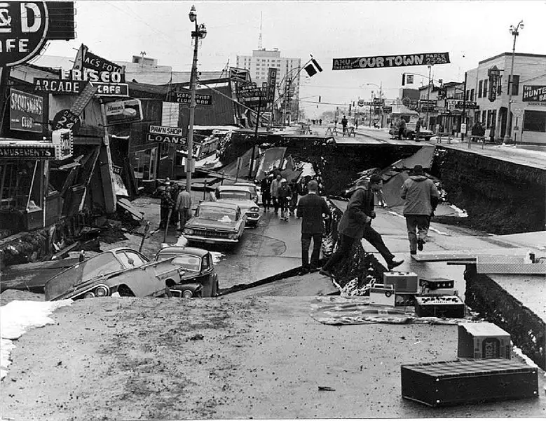
On March 27, 1964, a catastrophic seismic event struck Alaska, registering a staggering 9.2 magnitude. This monstrous jolt, known as the Great Alaska Earthquake or the Good Friday Earthquake, remains the most powerful earthquake ever recorded in U.S. history. Its violent tremors, lasting an astonishing four and a half minutes, reshaped landscapes and triggered devastating tsunamis that reverberated across the Pacific.
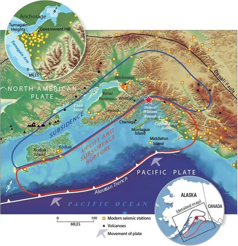
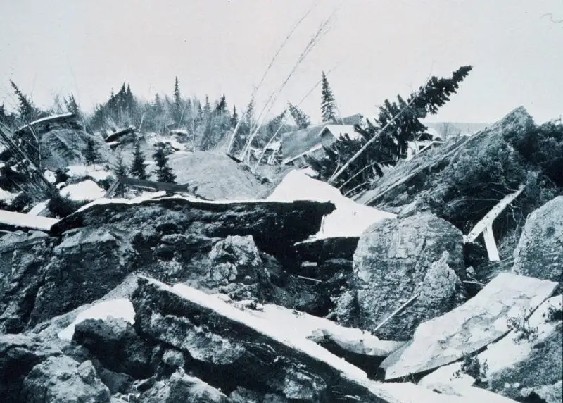
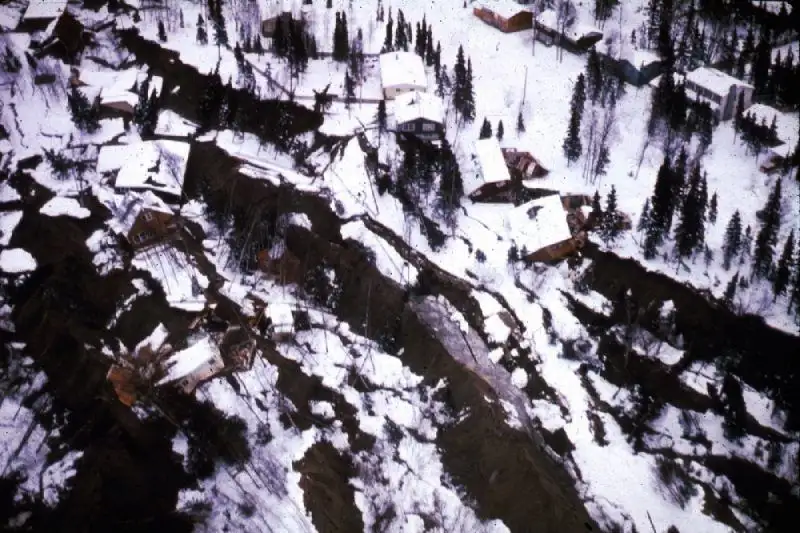
The earthquake's epicenter was located in Prince William Sound, southeast of Anchorage. The sheer force of the quake caused widespread destruction across southern Alaska. It permanently altered the Alaskan coastline, tilting vast areas and causing land to sink by as much as eight feet in some regions. Thousands of aftershocks followed, a testament to the immense scale of the fault rupture, which stretched for approximately 620 miles along the North Pacific Plate subduction zone.
Read More: Japan earthquake 7.5 magnitude triggers tsunami alerts April 20
The seismic upheaval unleashed destructive tsunamis. These waves of oceanic fury caused significant damage in coastal areas due to submarine landslides. The tsunami's reach extended far beyond Alaska, inflicting damage in places as distant as Crescent City, California, and even causing ripple effects in Hawaii and Northern California.
Beyond the immediate devastation, the 1964 Alaska earthquake left an indelible mark on the nation's approach to seismic preparedness and engineering. The event directly prompted major advancements in 'earthquake engineering' and the establishment of sophisticated 'tsunami warning systems' across the United States. Notably, the NOAA National Tsunami Warning Center in Palmer, Alaska, was established in the aftermath, a direct legacy of this seismic tragedy, working in tandem with the NOAA Pacific Tsunami Warning Center to monitor and warn about tsunami threats.
While the 1964 event was the most powerful, it's important to contextualize its fatalities. Compared to other massive global earthquakes, such as the 2004 Indian Ocean quake or the 2011 Japan quake, the death toll in Alaska, though tragic, was considerably lower. This starkly highlights that while seismic magnitude denotes sheer power, the human cost is influenced by a complex interplay of factors including location, warning systems, and population density. The earthquake caused approximately 131 deaths and injured thousands. President Lyndon B. Johnson declared Alaska an official disaster area.


