
Many individuals venturing outdoors increasingly depend on their smartphones for navigation, a trend that introduces potential risks. While digital maps offer convenience and advanced features, their limitations, such as battery dependence and susceptibility to technical failures, highlight the need for supplementary navigation methods. This reliance is evident across various age groups and experience levels, as people use a range of apps and digital tools to find their way. The growing popularity of outdoor activities, coupled with the widespread adoption of mobile technology, makes understanding these navigation strategies and their inherent vulnerabilities a pressing concern.
The current landscape of outdoor navigation shows a strong shift towards digital tools. A significant majority of people are using mobile devices to navigate trails and natural environments.
Widespread Digital Map Use: 81 percent of Norwegians use digital maps on their mobile phones when outdoors. Of these, a large portion, 93 percent, rely on common apps like Google Maps or Apple Maps.
Specialized Apps: 51 percent utilize maps designed specifically for outdoor activities, with 26 percent using training and hiking apps like Strava or Komoot.
Social Media Navigation: A smaller group, 15 percent, uses social media platforms for navigation cues.
Traditional Methods Persist: Despite the digital surge, traditional aids like marked trails, signs, cairns, paper maps, and asking for directions are still employed.
This widespread adoption of digital navigation raises questions about the robustness of these systems in diverse outdoor conditions and the preparedness of users for situations where technology fails.
Read More: Pittsburgh Best Hiking Trails 2024 Guide Shows Easy Walks Near City Center
The Mechanics of Digital Navigation
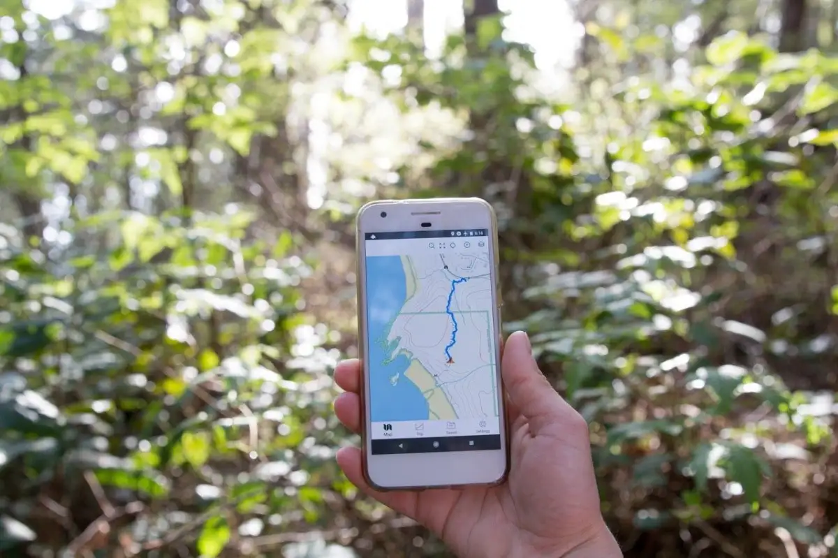
Smartphone-based navigation systems leverage advanced technology to pinpoint a user's location. Understanding how these systems function is key to appreciating both their capabilities and their potential failure points.
GPS Functionality: A phone's GPS receiver communicates with satellites to determine its precise location on Earth. This process does not require cellular service.
Offline Map Capabilities: Many applications allow users to download maps for offline access. This feature is crucial for areas with no cellular reception, enabling continued navigation. These downloaded maps often include topographical data and waypoints.
Track Recording: Devices can record a "breadcrumb trail" as a user moves, creating a visual log of their path on the map. Consistent GPS signal strength leads to a smoother track representation.
Battery Consumption: Extended use of GPS and screen display can significantly drain a phone's battery, a critical factor in remote settings.
While these features offer powerful navigation tools, the reliance on a single device, especially one with a finite power source, presents a clear vulnerability.

Backup Strategies: Addressing Technological Gaps
The inherent limitations of digital navigation, such as battery life and potential software glitches, underscore the importance of having backup methods. Experts and studies suggest a multi-faceted approach to ensure continued wayfinding capabilities.
Physical Maps: Traditional paper maps remain a reliable backup. Familiarity with a map's scale is essential for realistic planning and understanding surroundings.
Compass Skills: Basic compass skills, including triangulation and taking bearings, are recommended. These skills can corroborate a device's location data or provide navigation in the absence of any electronic aid.
Pre-Trip Planning: Downloading maps and planning routes over Wi-Fi before venturing outdoors is a standard recommendation. This ensures that essential navigation data is available even without a network connection.
Multiple Device Use: Some GPS watches also offer offline map capabilities, providing an alternative digital navigation tool.
The confluence of these strategies aims to create a more resilient navigation system for hikers and outdoor enthusiasts.
The Risk of Over-Reliance on Digital Tools
The convenience and perceived accuracy of digital navigation may inadvertently foster an over-dependence on technology. This can lead to a diminished development or retention of fundamental navigation skills, leaving individuals ill-equipped when digital tools falter.
Read More: Chrome mimeHandler API lets extensions handle file types
"Semantic Strategies": Users often employ a combination of navigation aids, including digital maps, physical signs, and natural landmarks. However, an over-emphasis on digital cues might overshadow the importance of understanding and interpreting the natural environment.
"Holistic Navigation Skills": Future navigation tools are encouraged to promote the development of comprehensive navigation abilities, rather than solely relying on technological representation.
"Backcountry Navigation Challenges": The increasing popularity of outdoor activities means more individuals are navigating remote areas with digital tools, a scenario where technology failures can have serious consequences.
The studies highlight that while digital tools are highly reliable, the psychological aspect of navigation and the cultivation of diverse wayfinding skills remain critical components of safe outdoor travel.
Expert Insights on Navigation and Safety
Navigating the outdoors safely and effectively, especially with the prevalent use of smartphones, requires careful consideration of both technological capabilities and fundamental preparedness.
"Future digital navigation tools must evolve to not only represent outdoor spaces more accurately but also encourage users to cultivate holistic navigation skills." (Article 2)
This statement points to a need for technology to support, rather than entirely replace, the user's own navigational abilities.
"Even simple software glitches can leave you without navigation when you need it most." (Article 3)
This underscores the vulnerability of relying solely on digital devices, highlighting the critical need for backups.
"Your smartphone, when used correctly, can be your navigator, your safety beacon, and your lifeline." (Article 6)
This emphasizes the dual nature of smartphones in outdoor settings – a powerful tool but one that requires proper usage and understanding of its limitations.
Conclusion: Balancing Technology and Preparedness
The evidence clearly indicates a strong and growing reliance on smartphones for outdoor navigation. While digital maps and GPS technology offer significant advantages in terms of accessibility and features, they are not infallible. The potential for battery depletion, software malfunctions, or signal loss in remote areas presents a substantial risk to hikers who depend solely on their phones.
Read More: BEREC Asks for Mobile Network API Ideas from Developers
The data suggests that:
A large majority of outdoor enthusiasts use digital maps.
Specialized outdoor apps and general mapping services are commonly employed.
Traditional navigation methods, while less prevalent, are still in use and can serve as critical backups.
There is a recognized need for users to develop "holistic navigation skills" that go beyond simply relying on a device.
Therefore, while embracing the utility of smartphone navigation, it is imperative for individuals to implement backup strategies. This includes:
Pre-downloading maps for offline use.
Carrying and knowing how to use a physical map and compass.
Understanding the limitations of their devices, particularly battery life.
This balanced approach, integrating technology with traditional preparedness, is essential for ensuring safety and successful navigation in outdoor environments.
Sources Used:
Article 1: "Here's why you need a backup for the map on your phone" | norwegianscitechnews.com | Published: 15 hours ago | https://norwegianscitechnews.com/2026/02/heres-why-you-need-a-backup-for-the-map-on-your-phone/
Article 2: "Why Having a Backup of Your Phone’s Map Is Essential: A Must-Know for" | bioengineer.org | Published: 15 hours ago | https://bioengineer.org/why-having-a-backup-of-your-phones-map-is-essential-a-must-know-for-every-smartphone-user/
Article 3: "Physical Maps: Your Backup When Tech Fails in 2025" | adventure-wiser.com | Seen on: Bing | https://adventure-wiser.com/physical-maps/
Article 4: "How to Use Your Phone as a GPS Device for Backpacking & Hiking | CleverHiker" | cleverhiker.com | Published: Oct 3, 2025 | https://www.cleverhiker.com/backpacking/how-to-use-your-phone-as-a-gps-device-for-backpacking/
Article 5: "Beginners guide to GPS navigation on trails" | hikematic.com | Published: Sep 25, 2025 | https://hikematic.com/beginners-guide-to-gps-navigation-on-trails/
Article 6: "A Hiker's Tech Guide to Navigation & Safety | Yoho Mobile - YohoMobile" | yohomobile.com | Published: Sep 15, 2025 | https://yohomobile.com/guide-tech-for-hiking-safety-and-navigation
Article 7: "Navigating Without a Signal: Essential Offline Tools for Backcountry Hikes | Chris Plaford | Outdoorsmanship" | chrisplaford.com | Published: Apr 11, 2025 | https://chrisplaford.com/navigating-without-a-signal-essential-offline-tools-for-backcountry-hikes/
Article 8: "How To Maximize Your Phone As A Backcountry Tool—Without Reception" | outdoorresearch.com | Published: Jun 5, 2019 | https://www.outdoorresearch.com/blogs/stories/how-to-maximize-your-phone-as-a-backcountry-toolwithout-reception
Article 9: "Why You Should Use Digital Navigation Methods for Hiking | The Adventure Gene" | theadventuregene.com | Seen on: Bing | https://theadventuregene.com/why-you-should-use-digital-navigation-methods-for-hiking/


