
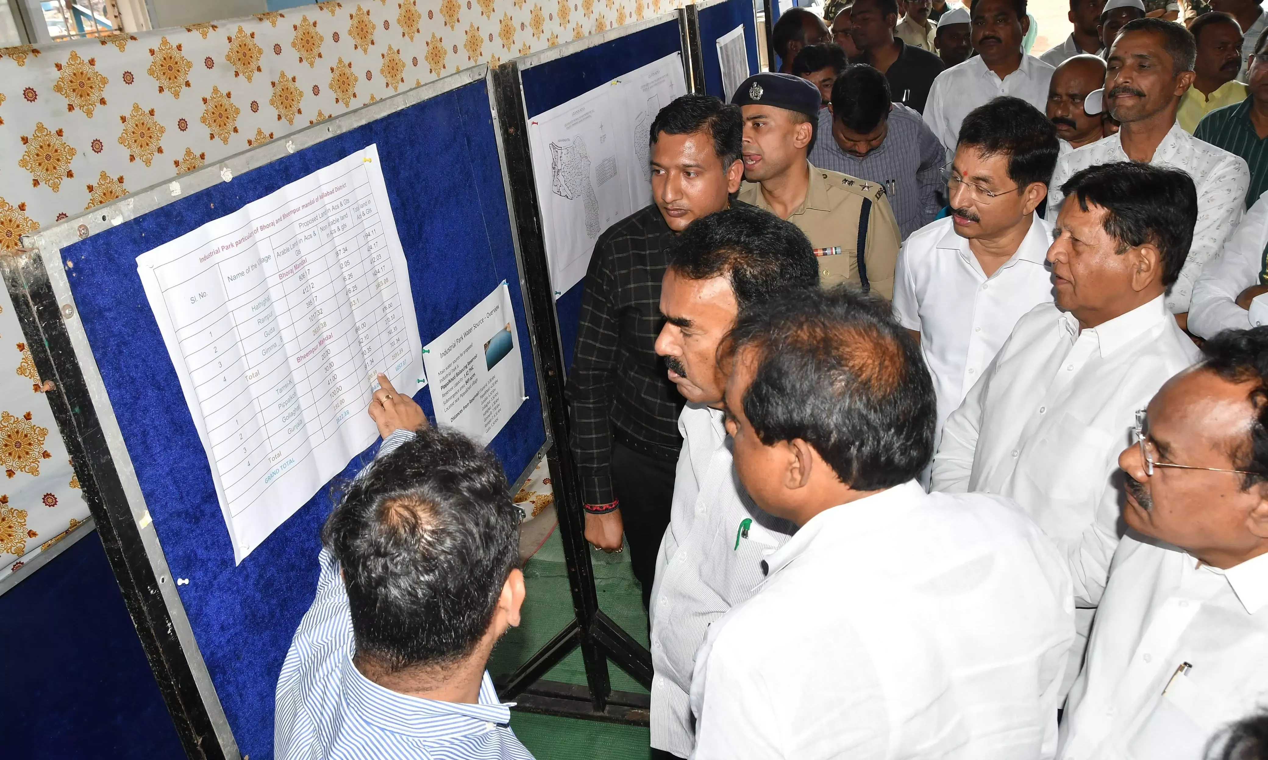
The Telangana government has mapped out 6,057.07 acres of soil in the Bheempur and Bhoraj mandals to build a massive Industrial Park. This plot of earth is divided between 2,822.38 acres of plowable land and 3,234.79 acres of barren dirt. While the state targets this zone for its position between Nagpur and Hyderabad, local politics has soured. Anil Jadhav, a BRS MLA, claims the state is hiding the blueprints.

In Bheempur, officials want 191 acres of farm ground.
In Bhoraj, the tally for arable land hits 2,631.38 acres, swallowing chunks of Hathigahat and Gimma (B).
The project has triggered a rift over transparency, as residents fear their homes are being mapped for destruction without a word of warning.
Rumors of Alcohol and Vanishing Dirt
"Information is being withheld… how can such units be established close to the Korata-Chanaka barrage?" — Anil Jadhav, BRS MLA.
The friction is thickest in the Bheempur mandal. Locals have heard whispers that the "industrial" label actually means liquor and ethanol factories. There is a heavy worry about the water. The proximity to the Korata-Chanaka barrage makes the idea of chemical runoff feel like a looming shadow. Villagers from Anukunta have already taken to the streets, claiming their houses showed up in the Airport Master Plan before they were even told a plan existed.
Read More: US Military Stops Listing Atheists and Humanists

The Arithmetic of the Land
The state’s hunger for space is specific. The breakdown of the identified 6,057 acres shows a heavy lean on Bhoraj for farming land and Bheempur for the harder, non-arable patches.

| Location (Mandal) | Arable Land (Acres) | Non-Arable Land (Acres) | Key Villages Affected |
|---|---|---|---|
| Bhoraj | 2,631.38 | 833.7 | Hathigahat, Guda, Gimma (B) |
| Bheempur | 191.00 | 2,372.79* | Tamsi (K), Pippalkoti, Gunjala |
*Aggregate calculated from specific village data provided by district officials.
The Aerial Gaze and Real Estate Shadows
The "leap" toward a New Industrial Heartland began with a helicopter ride. Chief Minister Revanth Reddy reportedly spotted the wide stretches of "barren" land from the air. Since then, the process has moved in silence. Jogu Ramanna, a former minister, suggests the "secrecy" is a mask for something else. There are accusations that certain politicians are sitting on the maps to drive up land prices in specific pockets, turning Real Estate into a private gold mine while the public waits for news.
Read More: UK Fields Turned into Camps Quickly Over Bank Holidays
The "leap" looks less like a jump and more like a forced push for those living in the way of the runways and factory walls.
Context: The Logistics of Cotton and Manganese
The government sees Adilabad as a wasted resource. The district is the largest Cotton Cultivation hub in the state, and the hills hold manganese, timber, and bamboo.
The plan is to stitch together a Ceramic Park and units for food processing and mining.
Revanth Reddy has stated he will meet Prime Minister Narendra Modi to push for the airport, framing the project as a necessary bypass to connect the remote north to the industrial flow of the south.
Critics, however, see a Big-Ticket Project that ignores the people standing on the ground it intends to pave over.


